Power Line Inspection and Corridor Scanning
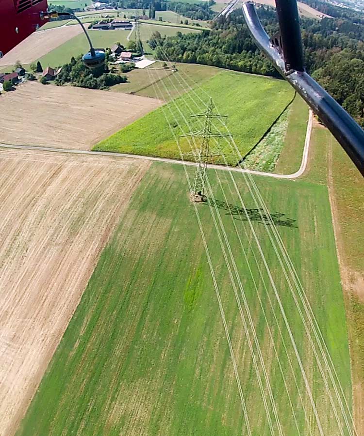
The availability and performance of high-voltage power lines is essential to almost all aspects of our society. Many countries have strict regulation for the continuous maintenance of high-voltage power lines and power masts in order to guarantee energy safeness and disposability. The focus of Aeroscout is the investigation of power line inspection in an efficient and accelerated way. For this, Aeroscout inspects power lines in Switzerland as a service for electricity companies in order to improve the UAV helicopters, the inspection payload and the workflow.
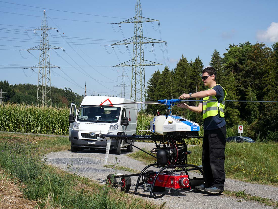
Today, the UAV helicopters of Aeroscout are used for the inspection of power line sections of 5 to 20km. But, the tendency is to increase the range of the mission by using the longer flight endurance of the UAVs (Scout B-330, 3h) and the BVLOS permissions to fly beyond visual line of sight. In 2015, Aeroscout participated as a main partner in a Swiss Confederation financed project (CTI) for two years.
| Project status | ongoing |
| Data typ | HD-photo and Video, LIDAR + Orthophoto, Corona Camera |
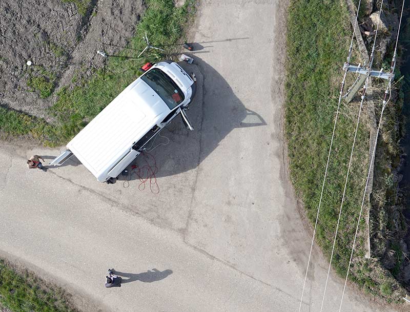
| UAV | Scout B1-100 & Scout B-330 |
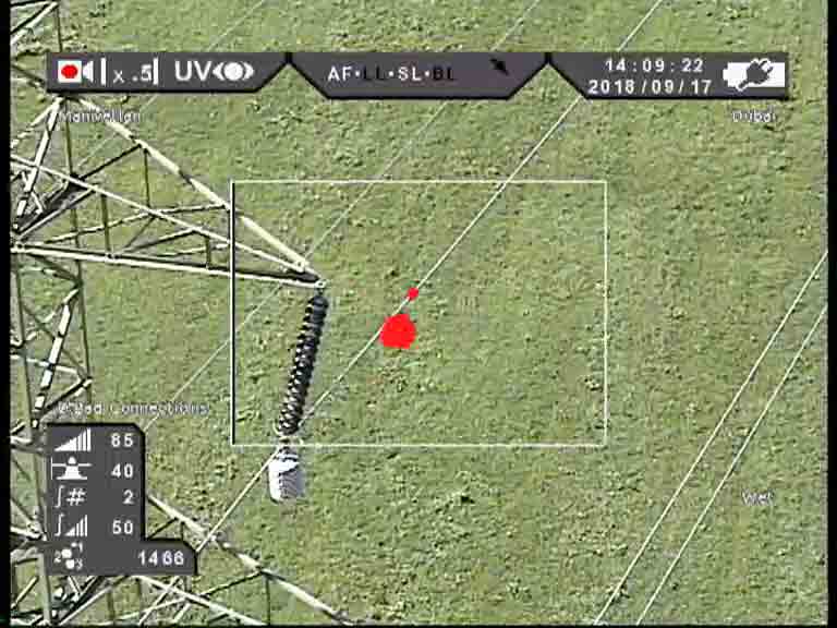
| Payload | ALMI LIDAR payload or customized Gimbal inspection payload for semi-automatic inspection |
| Completed missions | Obfelden - Zürich, Heidleitung GR, Wädenswil ZH, Adliswil ZH, and many more |
Aeroscout received the first license in Switzerland, 2016, which allows it to fly over an inhabited area with an UAV system in the weight class of the Scout B1-100 UAV and B-330 UAV (25kg-150kg). The reception of the license from the Swiss aviation authority was possible due to the many years of experience in the UAV business and the reliable UAV platforms B1-100 and B-330. Aeroscout is currently involved in the process of receiving the first BVLOS (beyond visual line of sight) permission in Switzerland to make power line inspection wih UAVs even more cost-effective.
Potree Point Clouds
Potree is a free open-source WebGL based point cloud renderer for large point clouds. You can find an example of a point cloud here:
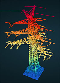
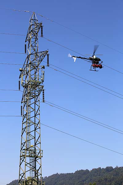
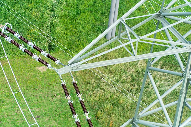
Single tower in a special 120deg configuration. Scanned for modeling in CAD to check the general condition and compare it against the old construction plans.
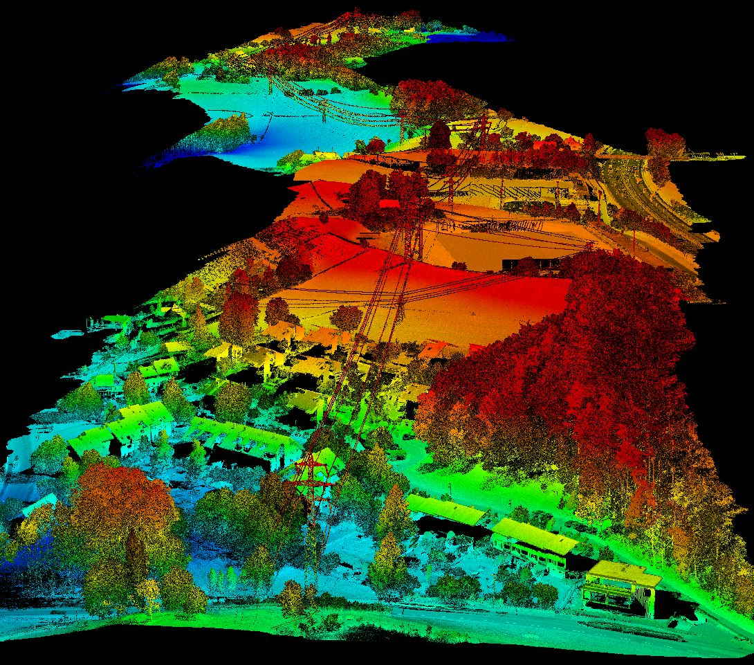
Corridor scan over populated area. It was necessary to plan the mission very precisly in order to minimize the overflown houses and people. This was a criterial to get the permission. However, it can be seen that also under such circumstances, the quality of the scan is not negatively influenced.
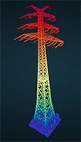
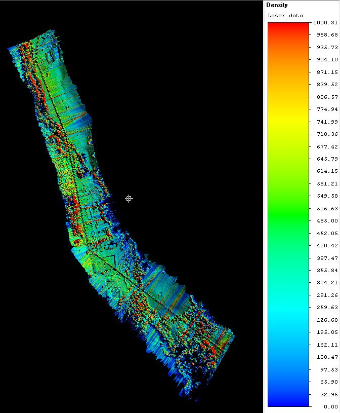
Rarity: Single tower 110m tall. This tower was built for crossing a waterway. The laser scan was made to check the general condition after several decades on duty.